
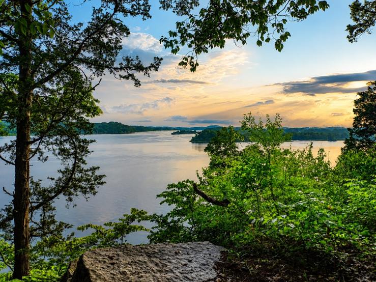
From the observation deck at Cherokee Trail of Tears State Park near Birchwood, Tennessee, one of Tennessee’s newest state parks, dedicated in June 2026, visitors can see the confluence of two mighty rivers: the Tennessee and the Hiwassee. Notably, the Hiwassee River begins high in the mountains of northeast Georgia, close to where I was raised, and flows over 130 miles in a generally northwesterly direction through the mountains of western North Carolina and eastern Tennessee before emptying into the Tennessee River. While the rivers are hard to miss, those familiar with the area’s history may also recognize the historically and archaeologically significant island situated between them. Human occupation of the island dates back as early as the Archaic period (8,500 BCE–4,000 BCE). Over the course of thousands of years, the island was occupied by several distinct cultures, including the Cherokee and at least three earlier peoples. Taken together, it is easy to understand why an interpretive panel in the park’s visitor center describes this place as a “cultural crossroads.” Today, this remarkable place is known as Hiwassee Island, though some also know it as Jolly’s Island for Cherokee Chief John Jolly, or Oolooteeskee, who once called the island his home.
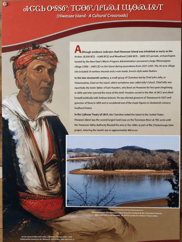
Rather than discussing the island’s entire lengthy history, this post will focus on the post-contact period of Cherokee inhabitation and the lives of Chief John Jolly and Sam Houston. By the early 1780s, following the withdrawal of the Chickamauga Cherokee from the area, Hiwassee Island had become an important Cherokee community. Jolly established his home and a successful trading post there. Following the Treaty with the Cherokee of 1817, which John Jolly signed as one of the representatives of the Arkansas Cherokee, he relocated west to Arkansas, joining his brother, Tahlonteeskee, and other Cherokee who had already begun establishing new settlements there. Jolly and the members of his community departed Hiwassee Island in 1818.
To understand this period, it is necessary to examine two treaties negotiated between the Cherokee Nation and the United States in 1817 and 1819. The Treaty with the Cherokee, concluded in July 1817, established a framework for Cherokee who wished to voluntarily relocate west of the Mississippi River to present-day Arkansas while allowing those who preferred to remain in the East to do so. President James Monroe emphasized in the treaty’s Preamble that the United States intended to accommodate both groups, declaring, “The United States, my children, are the friends of both parties, and, as far as can be reasonably asked, they are willing to satisfy the wishes of both.” As allowed for by the treaty, once the western Cherokee identified suitable lands that were not already occupied by another Native nation, the United States agreed to exchange those lands for a proportion of the territory relinquished in the East. In addition, Article II required the Cherokee Nation to cede land in present-day southeastern Tennessee. The cession encompassed, in part, territory lying north and west of a boundary beginning opposite the mouth of the Hiwassee River and extending across Walden’s Ridge toward the Sequatchie Valley. Significantly, the treaty did not specifically mention Hiwassee (Jolly’s) Island, a distinction that becomes important when examining the Treaty of 1819.
Two years later, in February 1819, the Cherokee Nation and the United States, for which Secretary of War John C. Calhoun was specially authorized by President Monroe, negotiated another agreement. This was also known as the Calhoun Treaty or “Hiwassee Purchase.” The treaty transferred a vast expanse of Cherokee land to the United States while serving as the “final adjustment” to the land cession and exchange provisions established under the 1817 treaty. Unlike the earlier treaty, however, the 1819 agreement specifically identified Hiwassee Island, stating that “all the islands in the Chestatee, and the parts of the Tennessee and Highwassee, (with the exception of Jolly’s Island, in the Tennessee, near the mouth of the Highwassee,)… belong to the Cherokee nation.” Although historians have interpreted this parenthetical exception differently, most conclude that Hiwassee Island was ceded to the United States in 1819.
For many visitors today, Hiwassee Island is perhaps best known as the place where a young Samuel “Sam” Houston sought refuge after running away from home. Long before his service in the War of 1812, becoming governor of Tennessee in 1827, serving as the first elected president of the Republic of Texas, and later elected governor of Texas in 1859 after annexation, Houston found refuge on Hiwassee Island among the Cherokee.
The timeline of Sam Houston begins on March 2, 1793, in Rockbridge County, Virginia, where he was born. In 1807, at the age of fourteen, the largely self-taught Houston relocated with his family to Greenback, near Maryville, Tennessee, following the death of his father the previous year. Just two years after beginning his new life in Tennessee, Sam ran away from home, making his way south to Hiwassee Island. I’ve often wondered what led him to make that decision.
The answer appears to lie in Sam’s difficult adjustment to life on the Tennessee frontier. While his siblings embraced the demanding labor of clearing land and farming, Sam was far more interested in reading and had little interest in the farming lifestyle. His independent nature frequently brought him into conflict with his family, which ultimately became the catalyst for his decision to leave. The Cherokee community on Hiwassee Island offered something very different: a place where Houston found acceptance, adventure, and a culture that deeply fascinated him. During the three years Houston lived on Hiwassee Island, he developed a close relationship with Chief John Jolly, who adopted him as his son and gave him the Cherokee name Colonneh (meaning “The Raven”). Houston also embraced many aspects of Cherokee culture and became proficient in the Cherokee language, a skill that would remain with him throughout his life.
Fast forward to the 1930s and 1940s, a period that is important for understanding the modern landscape of Hiwassee Island and the view of the Hiwassee and Tennessee Rivers today. On May 18, 1933, President Franklin D. Roosevelt signed the Tennessee Valley Authority Act, a New Deal initiative that established a federal corporation tasked, in part, with improving flood control and navigation on the Tennessee River and its tributaries. In 1936, the Tennessee Valley Authority (TVA) began construction of the 129-foot-tall, 5,800-foot-wide Chickamauga Dam. This hydroelectric facility was strategically positioned along the Tennessee River north of Chattanooga. The project was completed in 1940; however, even with the benefits of supplying hydroelectric power to the region, the landscape was forever changed.
Prior to the construction of Chickamauga Dam and the creation of Chickamauga Lake, Hiwassee Island spanned just under 800 acres and was reportedly the second-largest island on the Tennessee River. After the reservoir reached its full capacity in the early 1940s, the island was reduced to approximately 400 acres, effectively inundating nearly half of its original land area. Before the waters rose, excavations were conducted on Hiwassee Island in the late 1930s by the New Deal’s Works Progress Administration (WPA), targeting areas that would soon lie below the full pool level of Chickamauga Lake. This work uncovered a 30-acre Mississippian-period village containing 19 mounds. In addition, TVA removed other historically significant man-made structures, including the iconic Benham House. The communities on the island had long relied upon—and were largely made possible by—the very waters that would ultimately contribute to their demise. During the mid-1800s, Brown’s Ferry operated between Hiwassee Island and Rhea County on the opposite side of the Tennessee River. Although the historical record is silent regarding the ferry’s later names, it is known that by 1850 it had become known as Godsey’s Ferry.
The remarkable history of Hiwassee Island, including the legacies of Chief John Jolly and Sam Houston, is interpreted at the Cherokee Trail of Tears State Park Visitor Center. During the winter months, thousands of migrating waterfowl, including Sandhill Cranes, gather in the surrounding Hiwassee Wildlife Refuge, creating one of Tennessee’s premier wildlife spectacles. Although the island itself is not generally accessible to the public, its rich cultural and historical legacy continues to connect visitors with thousands of years of human history at the confluence of the Tennessee and Hiwassee Rivers.
All the best,
Craig
Bibliography and Suggested Reading:
https://treaties.okstate.edu/treaties/treaty-with-the-cherokee-1819-0177
https://treaties.okstate.edu/treaties/treaty-with-the-cherokee-1817-0140
https://www.worldhistory.org/Sam_Houston/?utm_
https://www.archives.gov/milestone-documents/tennessee-valley-authority-act#transcript
https://www.tva.com/energy/our-power-system/hydroelectric/chickamauga
Gross, Chuck. “Hiwassee (Jolly) Island.” 2014
Lewis, Thomas M. N., and Madeline Kneberg. Hiwassee Island: An Archaeological Account of Four Tennessee Indian Peoples. Knoxville: University of Tennessee Press, 1946.
 The Appalachian Record
Leave a comment